
search
Sydney road map
Road map of sydney. Sydney road map (Australia) to print. Sydney road map (Australia) to download. The Sydney roads map shows all road network and highways of Sydney. This roads map of Sydney will allow you to find your routes through the roads and motorways of Sydney in Australia. The Sydney roads map is downloadable in PDF, printable and free. Most Sydney residents travel by car through the system of roads, freeways and tollways (known as motorways). The most important trunk routes in the urban area are the nine Metroads, which include the 110 km (68 mi) Sydney Orbital Network as you can see in Sydney roads map. Sydney is also served by train, taxi, bus and ferry networks.
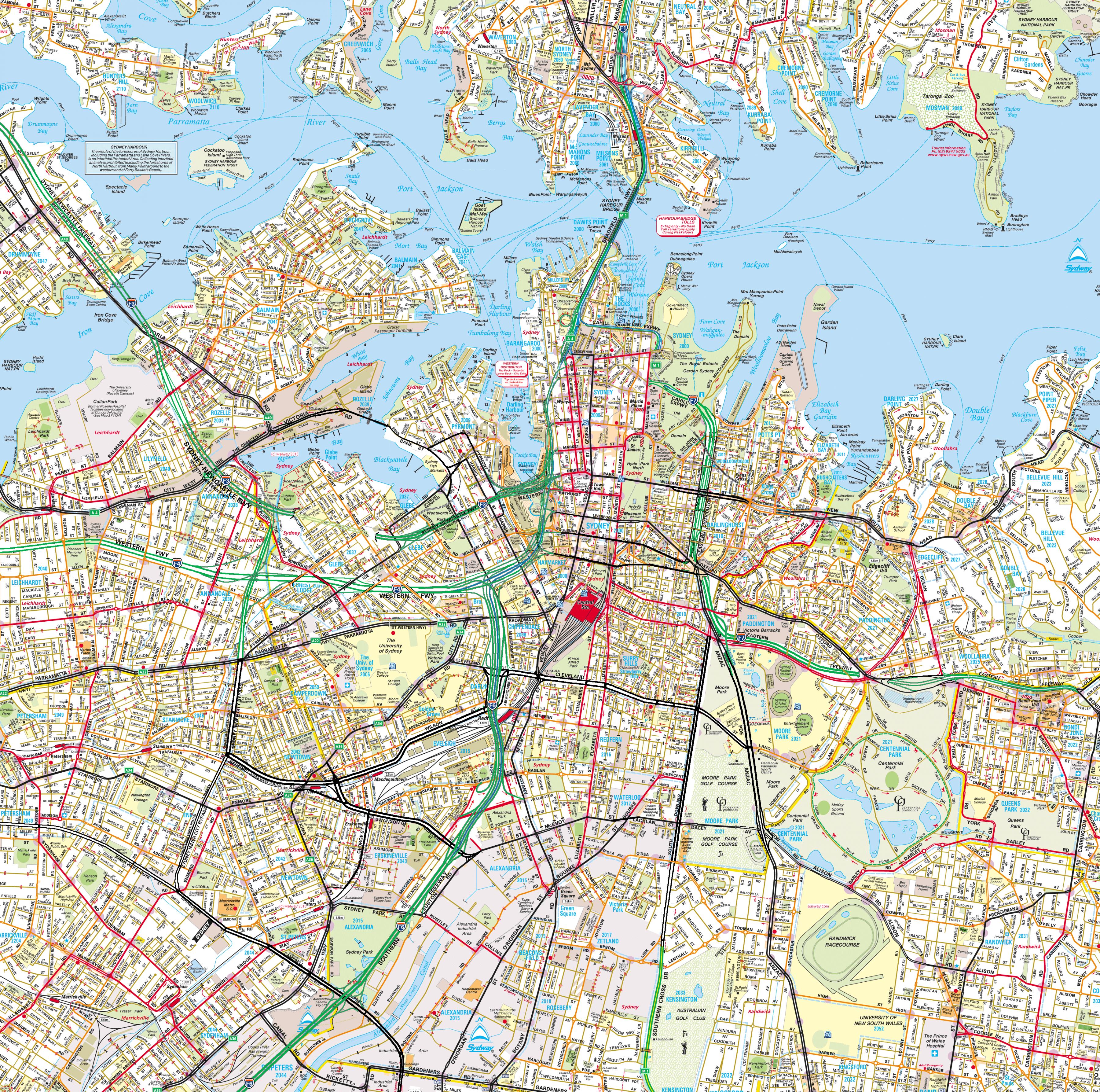
The Sydney Orbital Network is a 110 kilometre motorway standard ring-road or orbital around the city of Sydney, the capital of New South Wales in Australia as its shown in Sydney roads map. It runs north from Sydney Airport, underneath the CBD to the North Shore, west to the Hills District, south to Prestons and then east to connect with the airport. Planning for this beltway, orbital or ring road began as early as 1962 under the "county of cumberland scheme" (CCS) and well talked about as far back as 1944.
Metroads are the primary road routes serving the Sydney and Brisbane metropolitan areas in Australia. The Metroads form a network of radial and circumferential routes throughout the city, lengths of some of which are of freeway grade. Sydney Metroads are given the designation M (number) if they are of motorway standard, other Sydney Metroads and all Brisbane Metroads are sometimes known as Metroad (number) as its mentioned in Sydney roads map. Sydney Metroads will be replaced by Alphanumeric Routes.