search
Sydney street map
Street map sydney. Sydney street map (Australia) to print. Sydney street map (Australia) to download. George Street is the major street through central Sydney, it is often seen in terms of a number of distinct sections or precincts as its mentioned in Sydney street map. Oxford Street has made a name for itself for being one of the premier shopping streets in Australia. Running from the city through to Bondi Junction, you can easily spend a day walking up the street stopping for some retail therapy in Australian designer stores like Sass & Bide. Gould Street, Bondi Beach, it might be a small street, but it is one of the coolest strips in the city located a few blocks away from the world famous Bondi Beach as you can see in Sydney streets map. King Street, Newtown, this street is the epicentre of the trendy suburb of Newtown, lined with traditional terrace buildings now occupied by some of the city best restaurants, bars and boutiques.
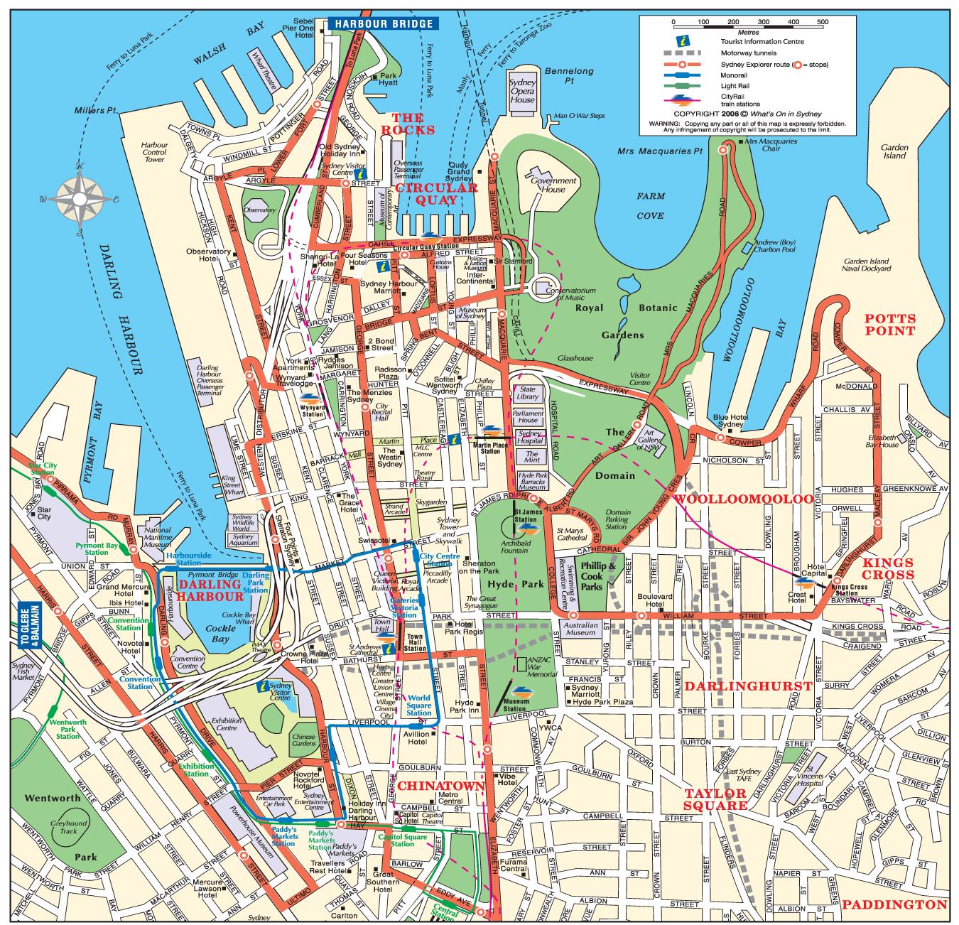
This streets map of Sydney will allow you to find your routes through the streets of Sydney in Australia. The Sydney streets map is downloadable in PDF, printable and free. Shopping locations in Sydney as its shown in Sydney street map include Pitt Street, George Street, King Street, Market Street, and Castlereagh Street, shopping complexes such as the Queen Victoria Building and Westfield Sydney, arcades such as The Strand Arcade and Mid City Centre, and department stores such as Myer and David Jones, all of which are in the shopping district in the city centre, a place to find major international brand name labels.
The Sydney street map shows all street network and main roads of Sydney. Sydney CBD runs along two ridge lines below Macquarie Street and York Streets. Between these ridges is Pitt Street, running close to the course of the original Tank Stream (now tunnelled). Bridge Street, took its name from the bridge running east-west that once crossed this stream. Pitt Street is the retail heart of the city which includes the Pitt Street Mall and the Sydney Tower as its mentioned in Sydney streets map. Macquarie Street is a historic precinct that houses such buildings as the State Parliament House and the Supreme Court of New South Wales.